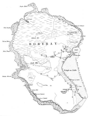
Boreray lies at the south-western corner of the Sound of Harris in the Outer Hebrides (Western Isles), west of Berneray and north of North Uist.
The island extends to almost 500 acres (200ha) in area. It is 1½ miles long and 1 mile wide. The highest point - Mullach Mor - is 184 ft (56m) above sea level.
Loch Mor virtually cuts the island in two. Severe winter storms cause waves to break over the narrow shingle causeway that separates the western end of the loch from the Atlantic.
|
 |
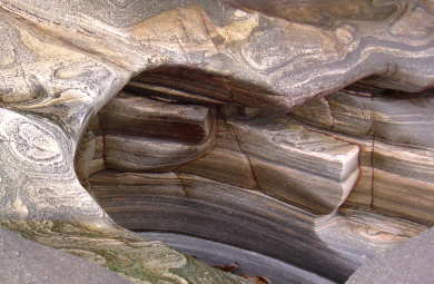
The northern, western and southern shores are rocky, consisting largely of Lewisian gneiss with quartz and white feldspar banding. The stone varies greatly in appearance, with many interesting patterns and formations to be found around the island.
Boreray's stone has been well utilised over the centuries. Remains of all kinds of buildings abound - everything from houses to a castle - in varying stages of dereliction. There are several ancient standing stones and a cup-marked rock (see History page for more info).
| |